 |
February 5th 2013, with hardly any sleep I went back home and changed by wet clothes and got a warm lunch and was getting ready to drive to Magherafelt to leave my computer in. For reasons I won't get into my computer needed formatted so I had it disconnected the previous night all ready to go and because of this I wasn't on the internet to know what kind of weather set-up was going on today however after the ice formations and the start of a thaw I figured the best was done until 13.00 when I looked out my bedroom window and saw an impressive line of convection towering high above the neighbours rooftops so I got in the car and drove swiftly to the bottom of the road to check out the scene with just half an hour until my appointment to sort out the computer.
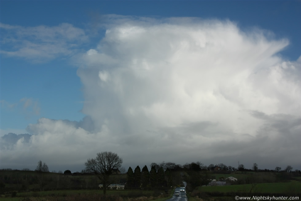
This image doesn't do the scene justice at all but I can tell you that the N to NE skyline was a place of pure beauty. Three large cells in a row where growing rapidly along the NE side of N. Ireland over Cusendall and Cusendun direction heading further inland, they had previously exploded to life over the warmer more unstable North Channel which was obviously a place with unstable air, cold air aloft, and convergence. The sun turned the row pure white against a crisp cold Winter sky and a proud anvil formed with some mammatus, these where thundersnow storms, or thunderstorms with snow, later checks showed several c-g lightning plots near the NE coast, and captured all the way from Maghera, read the full image report from this night here. * All images are available for sale in the form of photo prints, canvas or digital files for licensing, if you are interested in a purchase simply drop me an email.