 |
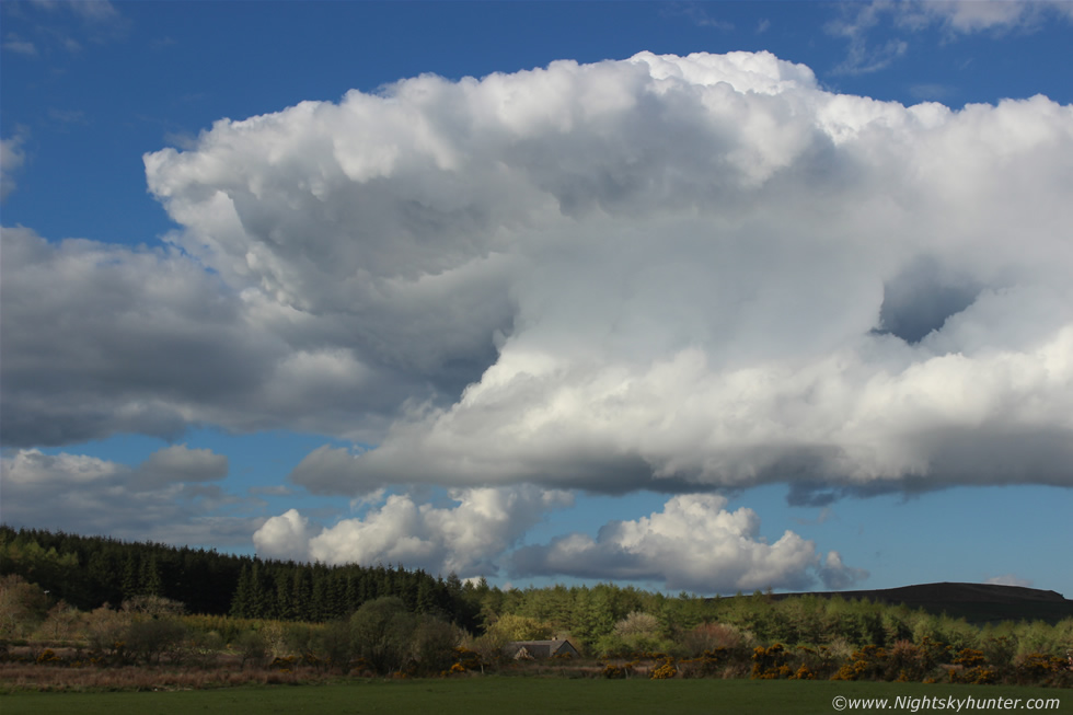
This greeted us on the way home from a 10 hour storm chase while on the Omagh Road heading N so we pulled into a narrow road to get images. This is a beautiful and quite dramatic example of capped convection, a cap or capping inversion is a mid level layer of warm air which stops convection from growing tall and turning into storms, you can visualize that process very well from this image, the towering cumulus grows vertically then hits the cap which acts like an invisible ceiling and since it cannot develop in height any further the clouds will spread out under that ceiling until the updraught decays and thats exactly what can be seen here, the spreading is very well defined here almost taking on the shape of a small anvil, we watched the entire process from birth to death which was fun to watch, this single cloud tried the hardest out of all the clouds we saw this day so I gave it my due respect, read the report for more information. * All images are available for sale in the form of photo prints, canvas or digital files for licensing, if you are interested in a purchase simply drop me an email.