 |
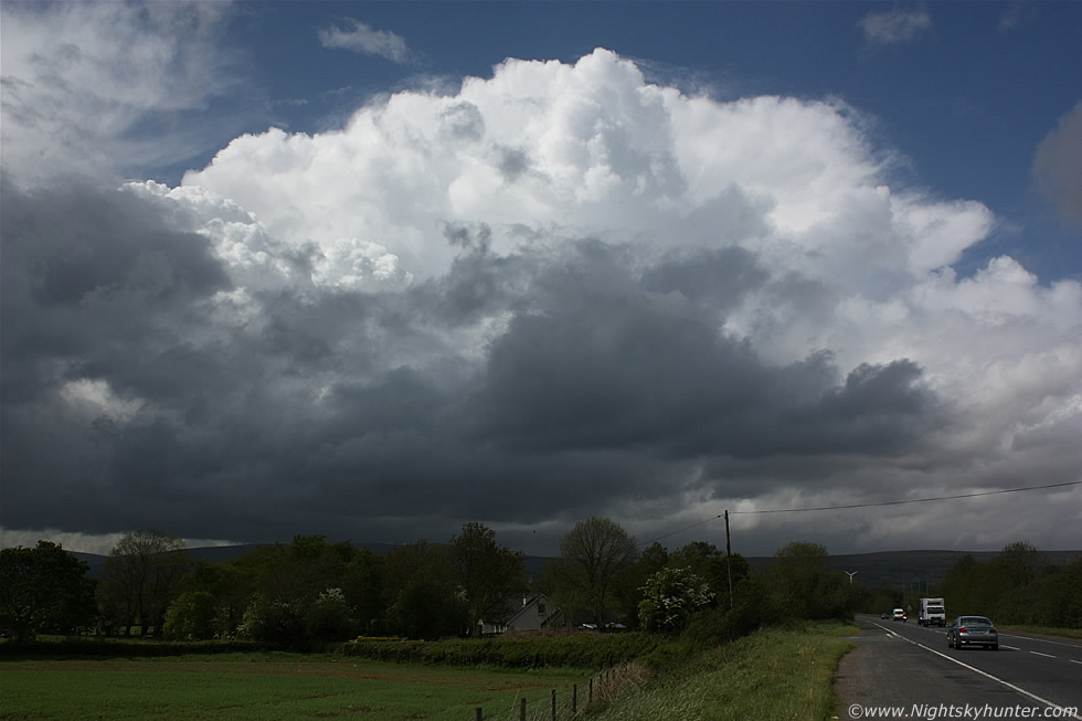
May 9th 2011 during the biggest severe thunderstorm outbreak since 2009. This was from Glenshane Pass after midday when storms kicked off much sooner than expected due to no cap, by early afternoon I was seeing storm after storm pass through this area. This is looking SE towards a beautiful distant organised multicell thunderstorm with explosive updraughts along the sides, flanking region, and a rock hard anvil over the main updraught, this big storm was moving NW towards Co. Derry where it would produce a large number of lightning strikes, read the report for more information. * All images are available for sale in the form of photo prints, canvas or digital files for licensing, if you are interested in a purchase simply drop me an email.