 |
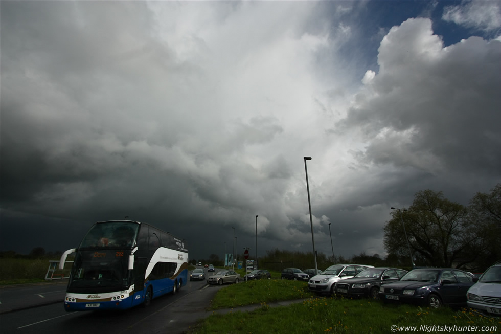
May 9th 2013, a nice outbreak of thunderstorms which formed in the Republic then moved N into E N. Ireland where clusters of cells produced c-g lightning and strong hail storms all over Co. Antrim. Reports from the M2 motorway on Twitter documented hail showers so intense that traffic had to stop, among these was an unconfirmed report of golf ball sized hail stones in the same area. I had been chasing this day on Glenshane Pass watching convection grow then headed into Antrim during the late afternoon to encounter these more nasty cells. There were plenty of dark menacing skies, alot of precip cores and lowerings everywhere I went. I chased outside Ballymena, through Randalstown then Toome, I core punched a nasty cell outside Randalstown which dumped a nasty hail core while I was on the motorway, I managed to emerge from the core then race ahead of the storm to get some structure, I finally stopped in Toome and took this image looking back E towards the advancing cell, this was beside the Park N Ride car park beside the roundabout. The storm can be seen with anvil, gust front, and heavy hail precip curtains beneath. Taken at 10mm ultra wide angle with the 212 Belfast-Derry/Londonderry bus which had just emerged from inside that hail storm. * All images are available for sale in the form of photo prints, canvas or digital files for licensing, if you are interested in a purchase simply drop me an email.