 |
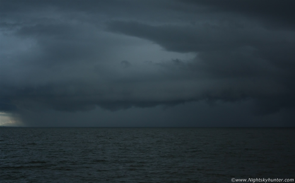
Late evening multicell thunderstorm heading directly towards me across Lough Neagh on June 28th 2012 captured from Ballyronan Marina, you can see the shelf cloud along the leading edge with half of the storm over water and the other half over land and extending out of frame to the R. This was a cell I had been watching on radar earlier and assumed it would die before it got to the Lough and yet here it was looking great rumbling away angrily. I set up my gear on the path near the edge and began shooting images while trying to get some video footage at the same time, I didn't have long before the precip arrived and I could already feel the chilling breeze from the storm's outflow catching me from across the lough. Images don't do this storm justice because it was some of the blackest skies I have ever seen along with an eerie blue tone, I had to ISO up to 400 for this shot and as I experimented with settings a periodic flash of lightning would reveal itself under the shelf. Just as I was looking through the viewfinder and getting focused for this vary image three rapid fire orange coloured bolts hit the water directly at image centre before I pressed the shutter button, what a shot this would have been had I took the image half a second sooner!, read the report for more information. * All images are available for sale in the form of photo prints, canvas or digital files for licensing, if you are interested in a purchase simply drop me an email.