 |
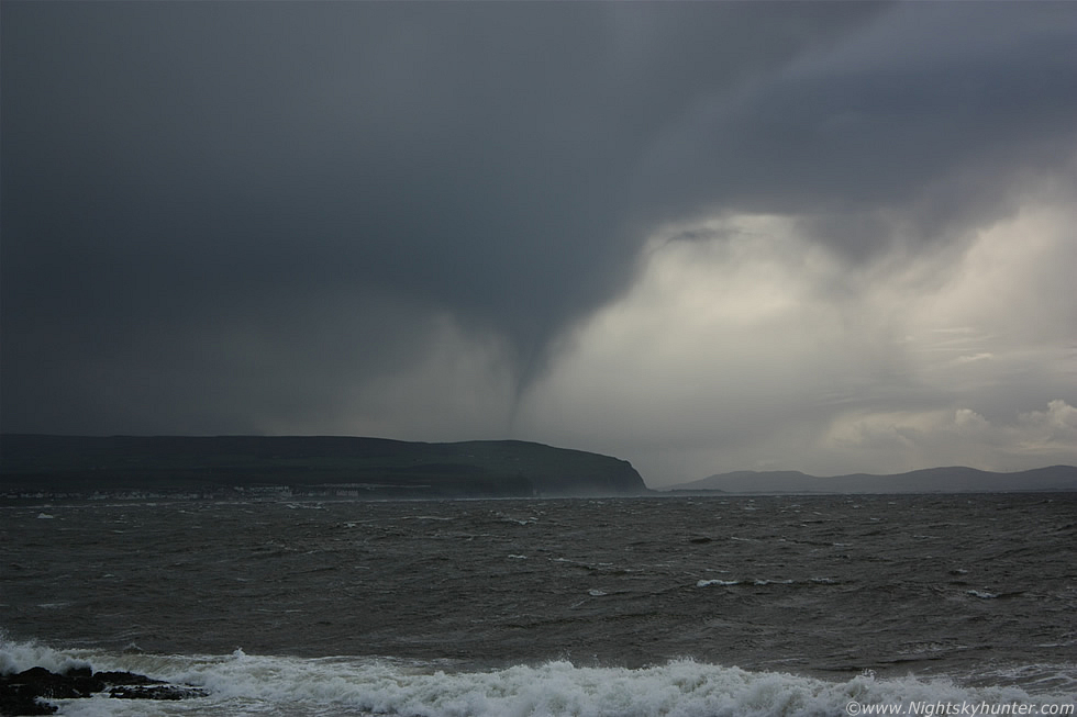
Looking NW across the Atlantic Ocean on October 18th 2011 from Portstewart I saw a dark convective cell moving from ocean to land, R to L on image with a heavy precip core of rain and hail, then a strange lowering suddenly appeared under the base to the rear of the cell at the inflow region which began to rapidly take shape into a suspicious form. At first I thought it was a narrow precip shaft but the more I watched the more I began to wonder so I stopped thinking for a moment and began shooting, I managed to get three images in total before the lowering vanished but during that time I could see an interesting funnel shape which seemed quite consistent in form during the entire period of observation. Could this have been a funnel cloud or even a waterspout?, I didn't see any rotation however this was not surprising considering the distance involved between me and the suspect funnel which was many miles away and probably even further than I perceived it to be at the time, which was 15.23 BST. This was at 55mm which was the maximum zoom I could get from the 18-55mm kit lens, read the report for more information. * All images are available for sale in the form of photo prints, canvas or digital files for licensing, if you are interested in a purchase simply drop me an email.